Want to get away from the bustle of the city to reset?
Looking for coastal wilderness day or multi-day hikes near Auckland?
Look no further than the west coast of Auckland where you’ll find the beautiful Waitākere Ranges Regional Park.
The Waitākere Ranges
Just 40kms out of Auckland City and with more than 16,000 hectares of native rainforest, rugged coastline, black sand beaches and natural treasures like the Kitekite and Karekare Falls, you’re sure to find more than you expect out west.
Before our trip, we did a day visit to Waitākere and visited the Arataki Visitor Centre to get some useful information about the region, camping options, and updates on any current road, track or campsite closures.
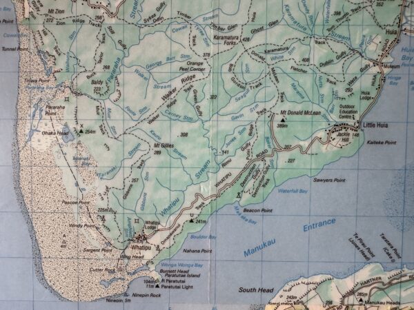
Then we planned, hiked, and tented for 3 days from Karamatura near Huia around the coast to Piha. These tracks form part of the 76.5km Hillary Trail which stretches between Arataki and Muriwai in the Waitākere Regional Park.
Due to Kauri dieback risk, the Hillary Track has been closed while the tracks within it are boxed, gravelled, board walked and staired to provide high-quality tracks and reduce disease spread.
In this post, you’ll find all you need to know about the sections we tramped so you can do them as day walks or as a multi-day hike, either following our route or, planning your own using this information.
Note: Unless you’re walking in and out on the same route, you’ll need transport from either end of your walk.
A Three-Day Hike In The Waitakeres, New Zealand
Day 1
Starting at Karamatura
Our group of six got dropped off at the Karamatura Valley Campground car park near Huia.
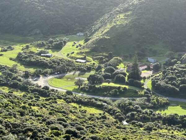
There’s plenty of parking, space to play or picnic and a toilet block. Not far from the car park is a campsite where you can tent. Walking access to it crosses the stream and takes just five minutes.
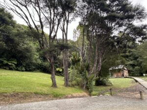
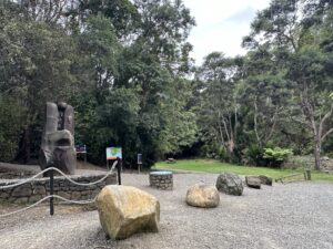
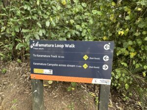
From the carpark we followed the Karamatura Loop Walk. This track is signposted at the edge of the carpark near the toilets. It took 20 or so minutes to join the Karamatura Track.
The path is gravelled and well-formed and winds through lush bush and alongside a stream briefly with a pretty flat gradient initially.
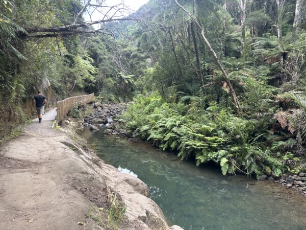
There’s the lovely Karamatura Falls just off the side of the track. The pool is deep enough for a dip and it’s worth the stop on a hot day.
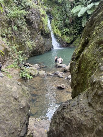
The Karamatura Valley Track leads on to the Donald McLean Track. You begin to climb consistently as you head up the valley. Enter the stairs!
Following the ridge line, you eventually come to a junction. We dropped our backpacks here.
Going straight ahead through the footwash station brings you to the Mt. Donald McLean car park.
Kauri Dieback
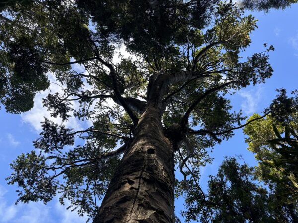
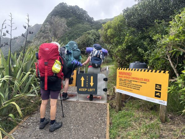
The stations are there so you can scrub and wash the soles of your boots with disinfectant. This is to slow down the spread of Kauri dieback disease which leads to the eventual death of NZ’s Kauri trees.
Since these trees are numerous in Waitākere, several foot wash stations are dotted throughout the park to help us all protect what remains of them.
Mount Donald McLean
You cross the car park to take the Mount Donald McLean Track which leads to the Mt Donald McLean peak and lookout.
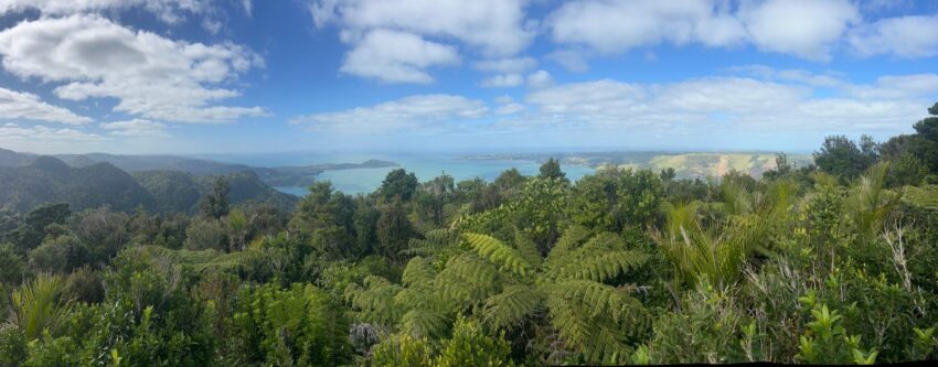
At a height of 389m, the top provides a 360°striking bush and ocean outlook worth the 20-minute detour up the hill and back.
With a wooden platform and views east and west to Whatipū, Manukau Harbour and Auckland, it’s a great place to stop, crack open a snack or drink and take your surroundings in.
Alternatively, you could drive up to the car park and after a quick 20-minute walk to the summit, you’d have a mint view or sunset spot.
Afterwards, double back through the foot wash station to the junction but, now take the Pūriri Track towards Whatipū as signposted.
Ōmanawanui
This links to the Ōmanawanui Track you want to follow, always heading for Whātipu, your final destination for the day.
The Ōmanawanui section of the track leads you up and down peaks along the northern edge of the Manukau Harbour entrance.
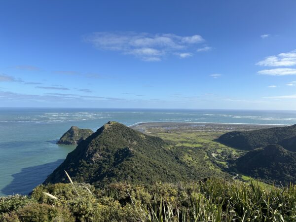
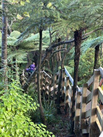
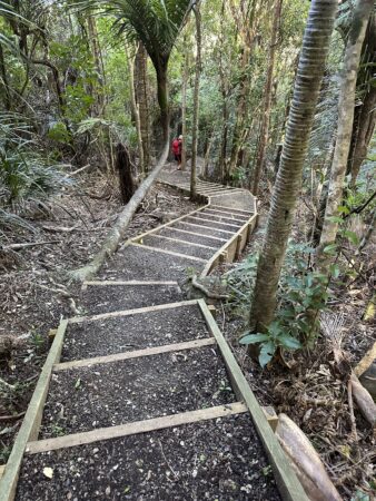
It has been revamped making it an easy-to-walk track, though the constant stairs up and down will make your calves ache the next day.
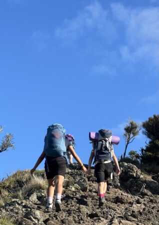
A trig marker signals the top of Ōmanawanui but the following knolls provide even more amazing views in my opinion, although the descents can be tough on your knees.
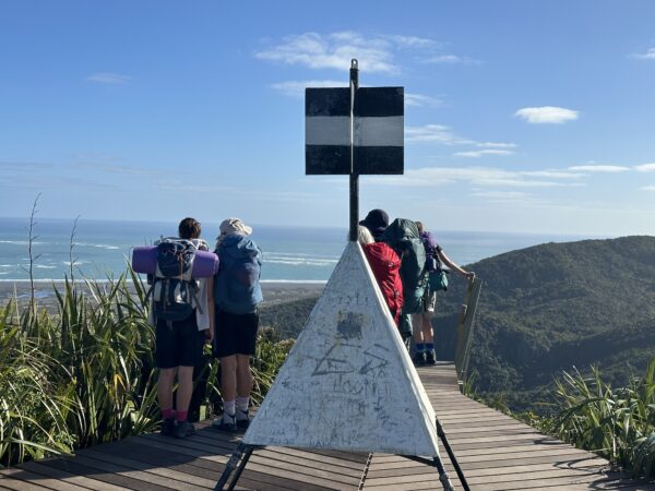
The cliff views of the surrounding coastal land and mottled blue sea are stunning and I reckon you’d be hard-pressed to find a better sunset vantage point than the end of this track.
On the opposite side you’ll see Awhītu Peninsula and, as you near the end, even the lighthouse perched at the Manukau Heads.
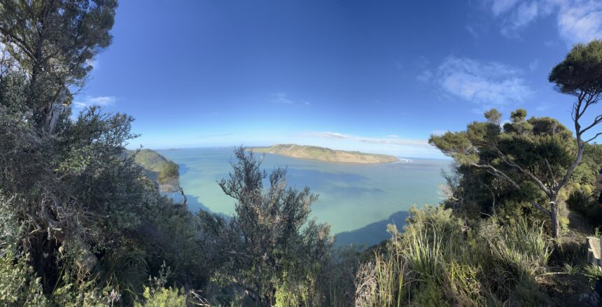
At one point we saw something swimming in the water far below. We stood watching for about 10 minutes and speculated that they were small groups of Maui dolphins.
They spread out over quite a distance and, while it was difficult to see exactly what they were from that high up, the dark, rounded backs and their speed of travel won us over.
From here, it’s steeply down sets of stairs to drop in altitude to sea level where the Whatipū Lodge and Campground are located.
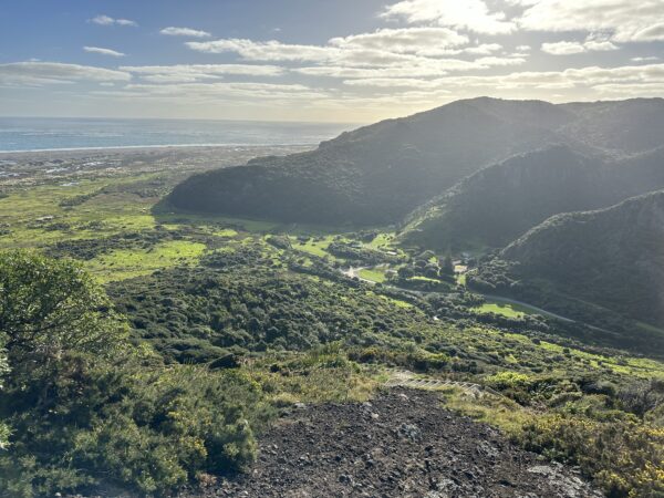
Whatipū Lodge and Campground
Nestled in the Whatipū valley, this a basic camp with two large areas for camping. The lower one gets pretty boggy heading into winter.
The upper area boasts a shed with a sink, running water and table/ sitting area. There’s also a composting toilet block and basic cold water shower on site.
Day 2
Whatipū Caves
After an early morning traipse to Whatipū Scientific Reserve, an area managed by Auckland Regional Council since 2002, to check out the Beach Beacon.
Waitākere boasts a log mining past and while you won’t still find the wharf, there once was one at the entrance to the Manukau Harbour, a stretch of water known for its currents and swells.
You can still find some of the wooden piles, driven into the dark sand, on the north side of Paratutae Island.
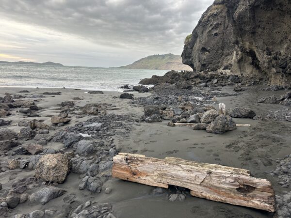
The black sand on the west coast is made of titanomagnetite – a mixture of titanium and iron. It comes from Mount Taranaki and is swept up the coast as far as North Cape, ground into finer grains as it goes.
You will find it in all your gear! Another interesting fact…Auckland’s black sands are mined and smelted into iron.
After breakfast, we took the Whatipū Caves trail that leads from the camp site/ car park.
The 20-minute walk to the caves takes you across little bridges, through bush and grassed terrain and along the coast to various caves and grottos at the southwestern point of the Waitākere Ranges. Several of the caves are large enough to venture into so a torch is handy.
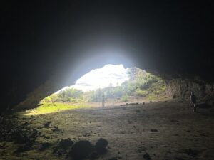
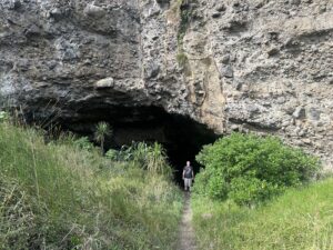
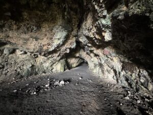
Years ago a Girl Guide group I was with camped the night in the largest one but that’s not offered any more, although the DOC toilet just past it is still there.
Before that, Maori used the cave as a place of shelter in pre-European times, and when settlers began logging kauri in Waitākere in the 1860s, they took advantage of its wide open spaces and high ceiling to get together and celebrate. People came to dances there from Karekare and Onehunga for over 60 years!
The Friends of Whatipū Facebook page says that “…dances were quite an event with lanterns lighting the interior of the cave and a driftwood bonfire blazing outside.”
The old timber floor is now buried under metres of sand.
Gibbons – Muir Tracks
Leaving the campsite at 10:45 am we took the Gibbons Track up the hill. The track branches off the Whatipū Caves track.
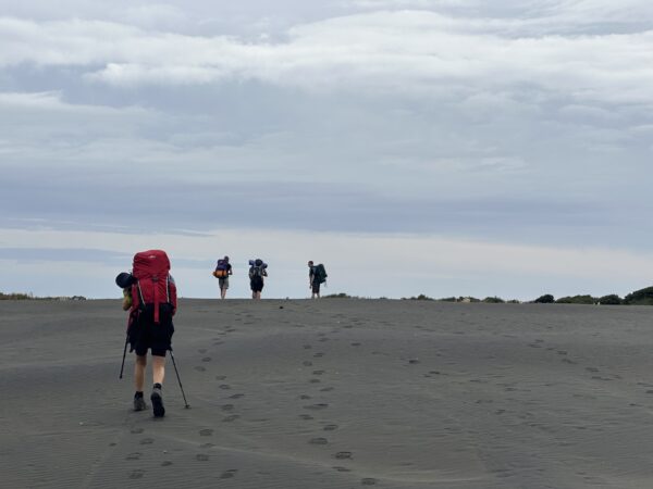
Gibbons Track has a steep climb from the Whatipū end. After that it levels off and there are plenty of beach views along the ridge until the turn onto Muir Track about 1 3/4 hrs along.
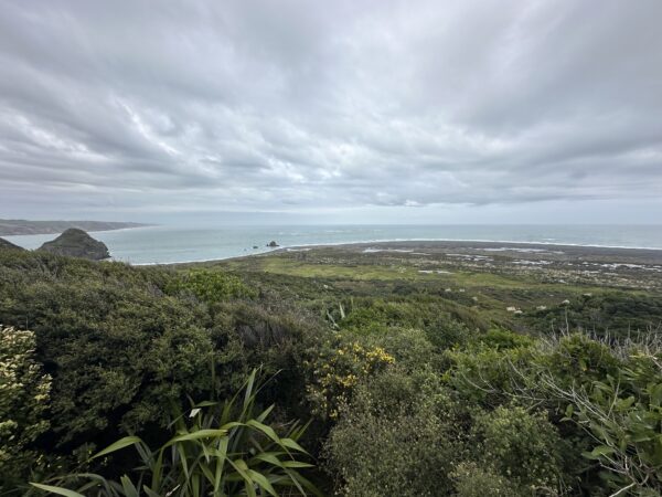
After turning onto Muir, you’ll descend to the Pararaha Valley. Towards the end of the Muir Track it gets pretty steep and you head down a rock face holding on to a rope bolted into the rock for a few metres.
Pararaha Valley
The bush-clad valley with its giant rocky outcrop provides spectacular views on the way down but there are very steep stair sections, particularly in the lead-down to the Pararaha Valley campsite.
This is a grassed campground at the foot of a hill with an open shelter surrounded by the stunning bush of the Pararaha Valley if you fancy a break or a spot of off-the-beaten-track camping.
There’s a composting toilet here – always carry paper just in case! Water must be taken from the stream and boiled or treated.
The trail leads to the beach at Pararaha Bay, and through the sand dunes, finally arriving at Tunnel Point campsite where we stayed the night.
Tunnel Point
Aptly named, there’s a simple shelter with a sink and two taps that run off tanked roof water at Tunnel Point Campsite, so boil or treat before using.
There is also a map, two picnic tables and a few flat grassy spots to pitch your tent.
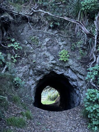
Nearby is a boiler left over from tree felling days that was too big to fit through the tramway tunnel, so it was just left to rust. In the past, the milling tramway on the beach faced issues from the water, salt and sand, but surprisingly continued operating until at least 1916.
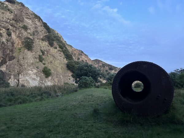
The campsite backdrop is marshland and cliff faces while the front takes you over dunes towards the beach – a superb spot to watch the sunset, though remember to take a torch for the trip home!
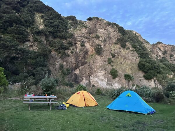
There were so many bird songs to be heard here at dusk and a night walk brought us face to face with the glowing yellow eyes of possums prowling around.
Day 3
The Pararaha Coastal Route
We had planned to take the Pararaha Coastal Route around Cowan Point into Karekare.
This requires the tide to be low. On the day we were there, low tide was 5.30 am so, it was an early start for us!
Alarms sounded at 5 am and we were packed up and ready to go within half an hour. We set off in the dark, first through the tramway tunnel then through the dunes by head torch light, which was a cool experience.
Thankfully this part of the trail is marked by white plastic posts with reflector strips so we could easily find our way on this section.
Then it breaks out onto the beach… You know heading north is the right way but the markers fade away, leaving only landmarks to navigate by if the route is new to you.
As the light fades in at sunrise (around 7 am in April) it becomes easier to tell where you are.
Karekare
In case you’re wondering, when you get to the small island stack head inland. That’s Karekare – surrounded by rugged coastal scenery that has been featured as the backdrop in films such as The Piano.
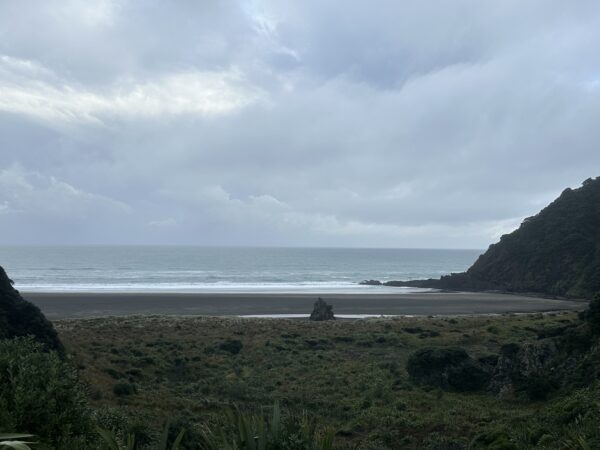
There was one light visible on the hillside – not the settlement size I was expecting! Plus in the dark and rain we had initially gone past and got to the rock outcrop beyond it.
Climbing to the top of that to see, we turned back and, standing on the beach, checked our topo map once the rain stopped.
We had made the right decision to turn back. The track didn’t go over the rocks but led inland before them. We headed for the grassy dunes.
First, we noticed the large grey surf lifesaving club building tucked into the hillside on the left as we headed in. Near that, a beach sand trail started which we followed.
It led us straight to the Karekare Reserve area. There was a sign, car park, ablution block, grassed areas and a picnic table where we stopped for our well-awaited breakfast.
Comans Track and Mercer Bay via Watchmans Road
Leaving the reserve you first walk left on Karekare Rd then left on to Watchmans Road shortly afterwards.
This path looks like an unsealed driveway and leads upwards for a short while. Persist. It does lead to the start of the Comans Track. The Ahu Ahu Track was closed at the time.
This bushy track leads onto the Mercer Bay Track, which becomes the Mercer Bay Loop Track.
Generally considered a challenging route, this route takes an average of 2 hours 46 min to complete. If you haven’t had enough of stairs, you will find more along the way as you meander up and down along the beautiful, rugged West Coast.
As it’s a popular area for hiking and the trail is open year-round, you’ll likely encounter other people while exploring this beautiful stretch. Dogs are welcome but must be on a leash.
At times, you literally stand on the cliff tops looking out across the Tasman Sea. The views are expansive and impressive.
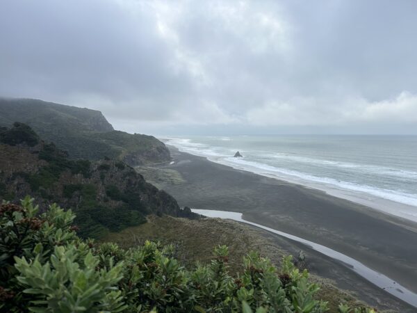
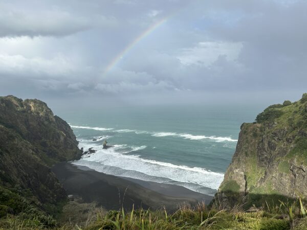
Along the way, Te Ahua Pa is marked by information signs so look out for those to gain insight into a slice of local Māori history. It was hard to imagine them having to scale those cliffs from their waka in the bays below or face windswept winters on the top of that headland.
Archaeologists say that Te Ahua Pa had formidable natural defences, with steep cliffs on three sides, so human and tsunami threats are thought to be responsible for their site selection.
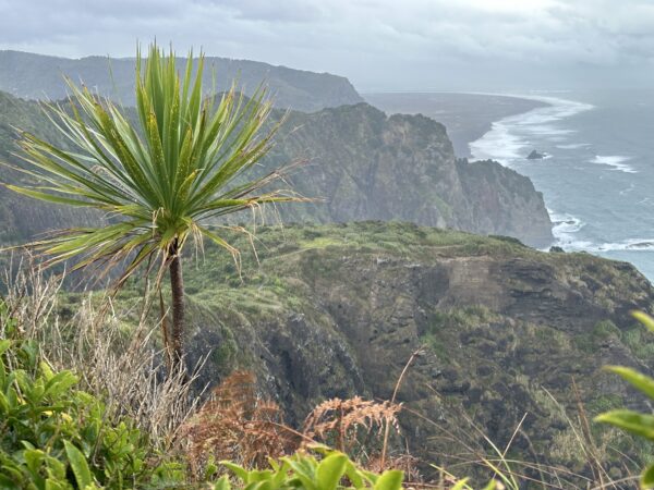
We took the slightly longer branch of the track (40 as opposed to 30 minutes). The track exits onto Log Race Rd.
This next section requires roadside walking. The road is not very wide and the walk down to Te Ahu Ahu Rd and then right onto Piha Road is about 3 km, which I’d avoid if you can.
Just on the junction of Karekare and Piha Rds, you can find the Ussher Track back into the bush.
Kitekite Falls
The Ussher Track leads on to the Winstone Track. Then you’ll take a left onto Kauri Grove Track, and another left on to the Connect/ Knutzen Tracks, all leading you to the impressive Kitekite Falls. These are well worth the visit and after morning rain, looked impressively white and three-tiered.
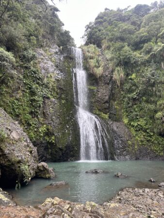
The Knutzen track out was closed so we doubled back to the last junction, took the Kitekite Track and followed that for 25 minutes.
This brings you out to the Glenesk Road car park – a perfect pickup point and the end of our hike.
Just down the road is the township of Piha so take a look. It’s well known for its black sand beach, great surf and strong rip currents.
Lion Rock is a highlight landform in the middle of the beach that you can quickly climb but there are other walks and activities like swimming, surfing, hiking, horse riding, blo karting and sunbathing to be enjoyed too if you have the time.
Tips for visiting the Waitakere Ranges in West Auckland:
- The Waitakeres aren’t accessible by public transport but you can join an organised tour, drive yourself or arrange to get dropped off and picked up by someone.
- Walking can get tiring, especially with a pack. Pack light and know your limits.
- Check apps like Plan My Walk and All Trails to map your routes and get up-to-date information about the tracks you want to walk.
- Weather in Auckland is variable – take a warm layer and rain gear, snacks and water with you.
- Even on overcast days, radiation is high so wear a hat and sunscreen.
- Walking poles are recommended – these coastal trails have several stairs that can hammer your knees and the extra support of poles could be invaluable.
- Take plenty of water (2L or more) and trail snacks on every walk.
- Let someone know where you’re going and when you expect to get back. Tell them to ring 111 if you’re way overdue.
- ‘Deep Heat’ helps muscles re-adjust after doing lots of stairs!
- Taking a phone to act as a torch and for capturing pictures of your trip may add to your memories, although cell signal for calling was sketchy in most places we went.
- All Auckland’s regional parks are rubbish-free. Take all rubbish and recycling with you when you leave.
Other great posts you might enjoy:
Best Spots to visit in the Waikato
Top Apps for travel in New Zealand
For more ideas head to our travel page.
I hope you enjoyed reading about our trip from Karamatura to Piha in the Waitākeres and that your time in Auckland’s outdoors is pleasant and safe.
Please pin this post to save or share.

Thanks for dropping by!

Meagan

